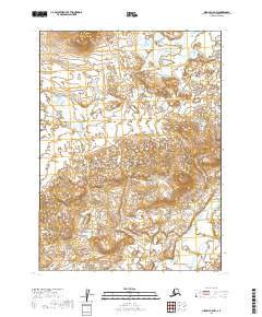
2019 Map of Iliamna C-8 NW
USGS Topo · Published 2019About this map
The Stuyahok River and Kaskanak Cr dominate this section of the Lake and Peninsula Borough, winding through an landscape defined by intricate hydrologic networks. This 2019 survey documents the complex system of small lakes and ponds that saturate the terrain between these two water bodies, a characteristic pattern for this remote interior region of Alaska. The map provides a high-resolution view of the local drainage basins across several townships, including t5s r39w, showing how the low-lying wetlands interact with the river systems. For researchers of Alaskan geography, this sheet offers a clear record of the shifting watercourses and topographical contours that dictate movement and land use in this roadless wilderness.
Find a feature on this map
7 named features on this map. Tap any name to fly to it.
Don’t see what you’re looking for? This feature index may not catch every label — zoom into the map to look around manually.
Map Details
Editions of this 2019 Iliamna C-8 NW Map
This is the sole edition of this map. No revisions or reprints were ever made.
Other maps of this area

1951 · Dillingham
USGS Topo · 1:250,000

1952 · Iliamna
USGS Topo · 1:250,000

1954 · Iliamna C-8
USGS Topo · 1:63,360

1954 · Iliamna D-8
USGS Topo · 1:63,360

1954 · Dillingham
USGS Topo · 1:250,000

1954 · Dillingham C-1
USGS Topo · 1:63,360

1954 · Dillingham D-1
USGS Topo · 1:63,360

1957 · Iliamna
USGS Topo · 1:250,000
2019 · Iliamna C-8 SW
USGS Topo · 1:25,000
2019 · Iliamna C-8 NE
USGS Topo · 1:25,000