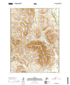
2019 Map of Iliamna D-8 SW
USGS Topo · Published 2019About this map
The Koktuli River and the Stuyahok River define the hydrography of this wild region within the Lake and Peninsula Borough. These two waterways serve as the primary geographical anchors for a landscape otherwise characterized by intricate wetland patterns and shifting elevations. The lack of named settlements or man-made structures on this 2019 survey reflects the region's status as a largely roadless interior, where the natural drainage of the rivers dictates the movement and access for those navigating the terrain. This map provides a precise record of the river courses and land divisions, including sections of t4s r39w and t5s r39w, useful for documenting the physical geography of the Alaska Peninsula's interior before future environmental or industrial changes.
Find a feature on this map
10 named features on this map. Tap any name to fly to it.
Don’t see what you’re looking for? This feature index may not catch every label — zoom into the map to look around manually.
Map Details
Editions of this 2019 Iliamna D-8 SW Map
This is the sole edition of this map. No revisions or reprints were ever made.
Other maps of this area

1951 · Dillingham
USGS Topo · 1:250,000

1952 · Iliamna
USGS Topo · 1:250,000

1954 · Iliamna C-8
USGS Topo · 1:63,360

1954 · Iliamna D-8
USGS Topo · 1:63,360

1954 · Dillingham
USGS Topo · 1:250,000

1954 · Dillingham C-1
USGS Topo · 1:63,360

1954 · Dillingham D-1
USGS Topo · 1:63,360

1957 · Iliamna
USGS Topo · 1:250,000
2019 · Iliamna C-8 NE
USGS Topo · 1:25,000
2019 · Iliamna C-8 NW
USGS Topo · 1:25,000