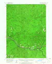
1955 Map of Illahee Rock
USGS Topo · Published 1964About this map
The North Fork Umpqua River carves through the heart of the Douglas County backwoods, establishing a landscape defined by sharp ridges and seasonal shelters during the mid-1950s. The region is marked by a network of forest service infrastructure and historical camps such as Illahee Guard Sta and Island Forest Camp. High-elevation observation points like Johnson Butte Lookout and Chilcoot Mtn Lookout emphasize the era's reliance on stationary fire lookouts for wilderness management. Along the river, landmarks like Steamboat Point and the Power House indicate the early development of hydroelectric and water resources. The terrain is notably etched with family-named or descriptive features like Lemon Butte, Harding Butte, and Bona Fida Shelter, providing a detailed look at the backcountry pathways and remote homesteads used before modern road systems fully penetrated the southern Cascades.
Find a feature on this map
139 named features on this map. Tap any name to fly to it.
Don’t see what you’re looking for? This feature index may not catch every label — zoom into the map to look around manually.
Map Details
Editions of this 1955 Illahee Rock Map
3 editions found
Other maps of this area

1917 · Diamond Lake
USGS Topo · 1:125,000

1925 · Waldo Lake
USGS Topo · 1:125,000

1935 · Lowell
USGS Topo · 1:96,000

1942 · Lowell
USGS Topo · 1:125,000

1955 · Quartz Mtn
USGS Topo · 1:62,500

1955 · Red Butte
USGS Topo · 1:62,500

1955 · Mace Mtn
USGS Topo · 1:62,500

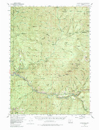
1955 · Illahee Rock
USGS Topo · 1:62,500

1955 · Fairview Peak
USGS Topo · 1:62,500

1955 · Culp Creek
USGS Topo · 1:62,500