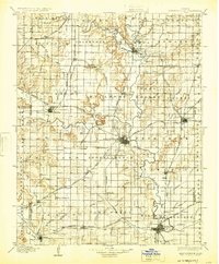
1905 Map of Independence
USGS Topo · Published 1925About this map
Independence serves as the central hub of this turn-of-the-century landscape, situated where the Atchison Topeka and Santa Fe and Missouri Pacific lines converge. The river systems define the region’s geography, with the Verdigris River and Fall River snaking through the eastern and northern reaches, while the Little Caney Creek and Caney dominate the southwest. Distinctive topographic markers like Table Mound, Buff Mound, and Walker Mound rise above the surrounding prairies, providing natural landmarks for the scattered farming communities.
Find a feature on this map
95 named features on this map. Tap any name to fly to it.
Don’t see what you’re looking for? This feature index may not catch every label — zoom into the map to look around manually.
Map Details
Editions of this 1905 Independence Map
4 editions found

Other maps of this area

1885 · Eureka
USGS Topo · 1:125,000

1885 · Sedan
USGS Topo · 1:125,000

1886 · Fredonia
USGS Topo · 1:125,000

1886 · Iola
USGS Topo · 1:125,000

1886 · Independence
USGS Topo · 1:125,000

1886 · Parsons
USGS Topo · 1:125,000

1888 · Eureka
USGS Topo · 1:125,000

1889 · Sedan
USGS Topo · 1:125,000

1893 · Iola
USGS Topo · 1:125,000

1893 · Parsons
USGS Topo · 1:125,000