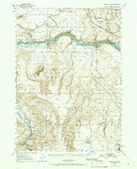
1948 Map of Indian Cove
USGS Topo · Published 1966About this map
The Snake River carves through this high desert landscape, defining the border between Elmore and Owyhee counties in the late 1940s. Traces of western migration are visible along the historic Oregon Trail, which parallels the northern banks of the river and the Union Pacific railroad line near Chalk Spur. This era shows a landscape transitioning between pioneer history and modern utility, where the river's path is interrupted by the Buckaroo Dam and the Harris Dam.
Find a feature on this map
55 named features on this map. Tap any name to fly to it.
Don’t see what you’re looking for? This feature index may not catch every label — zoom into the map to look around manually.
Map Details
Editions of this 1948 Indian Cove Map
2 editions found

Other maps of this area

1892 · Mountain Home
USGS Topo · 1:125,000

1892 · Camas Prairie
USGS Topo · 1:125,000

1893 · Mountain Home
USGS Topo · 1:125,000

1893 · Camas Prairie
USGS Topo · 1:125,000

1947 · Bruneau
USGS Topo · 1:62,500

1947 · Indian Cove
USGS Topo · 1:24,000

1947 · Hammett
USGS Topo · 1:24,000

1947 · Sand Dunes
USGS Topo · 1:24,000

1947 · Bruneau
USGS Topo · 1:24,000

1947 · Sugar Valley
USGS Topo · 1:24,000