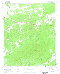
1967 Map of Indian Mountain
USGS Topo · Published 1969About this map
Indian Mountain dominates the southern landscape of this border region where Alabama meets Georgia, acting as a natural divide between the northern agricultural valleys and the industrial mining corridors to the south. The rural settlement patterns of the late 1960s are evident in the clustering of McCord Crossroads and Adams Crossroads, while the southern edge of the map reveals the heavy footprint of the Southern railroad. This rail line connects the small communities of Bluffton, Tecumseh, and Etna, which historically served the local mineral extraction and timber interests. Throughout the hills, numerous country churches such as Pilgrims Rest Ch, Bethel Ch, and Nazareth Ch anchor the social geography of the area. Significant watercourses like Forney Creek and Lumpkin Mill Creek provide the primary drainage for the ridgeline, which is marked by prominent peaks including Wolfden Mtn and Flagpole Mtn.
Find a feature on this map
64 named features on this map. Tap any name to fly to it.
Don’t see what you’re looking for? This feature index may not catch every label — zoom into the map to look around manually.
Map Details
Editions of this 1967 Indian Mountain Map
3 editions found
Other maps of this area

1886 · Rome
USGS Topo · 1:125,000

1889 · Tallapoosa
USGS Topo · 1:125,000

1892 · Tallapoosa
USGS Topo · 1:125,000

1893 · Fort Payne
USGS Topo · 1:125,000

1897 · Tallapoosa
USGS Topo · 1:125,000

1898 · Rome
USGS Topo · 1:125,000

1898 · Fort Payne
USGS Topo · 1:125,000

1899 · Rome
USGS Topo · 1:125,000

1900 · Fort Payne
USGS Topo · 1:125,000

1900 · Anniston
USGS Topo · 1:125,000