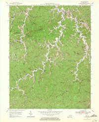
1954 Map of Inez
USGS Topo · Published 1971About this map
Inez serves as the focal point of this 1954 topographical study, situated at the confluence of Castle Creek and the Middle Fork of the Tug River system. The landscape is defined by an intricate network of narrow hollows and ridge-top settlements, where the extraction of natural resources is evident through numerous Gas Well sites scattered across the terrain. Small communities and family-named landmarks illustrate the post-war rural character of Martin County, with local life centered around institutions like Stafford Pk Ch and Davella Ch.
Find a feature on this map
76 named features on this map. Tap any name to fly to it.
Don’t see what you’re looking for? This feature index may not catch every label — zoom into the map to look around manually.
Map Details
Editions of this 1954 Inez Map
3 editions found
Other maps of this area

1886 · Prestonsburg
USGS Topo · 1:125,000

1887 · Warfield
USGS Topo · 1:125,000

1891 · Warfield
USGS Topo · 1:125,000

1892 · Prestonsburg
USGS Topo · 1:125,000

1910 · Naugatuck
USGS Topo · 1:48,000

1912 · Naugatuck
USGS Topo · 1:62,500

1914 · Laynesville
USGS Topo · 1:48,000

1914 · Inez
USGS Topo · 1:48,000

1915 · Williamson
USGS Topo · 1:48,000

1915 · Naugatuck
USGS Topo · 1:48,000