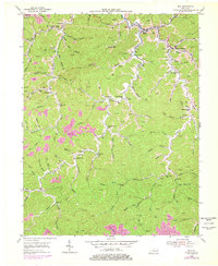
1954 Map of Inez
USGS Topo · Published 1978About this map
The town of Inez serves as a central hub in this Appalachian landscape, where narrow valleys dictate the pattern of settlement and industry. By the mid-1950s, the region's economy is clearly defined by an extensive network of Gas Wells and significant Strip Mine operations that dominate the southern ridges. Small rural communities like Davella and Tomahawk are anchored by local institutions, including the Davella Ch and Sulphur Spring Ch, which provided social structure for the families living along the winding forks of the Big Sandy River watershed.
Find a feature on this map
79 named features on this map. Tap any name to fly to it.
Don’t see what you’re looking for? This feature index may not catch every label — zoom into the map to look around manually.
Map Details
Editions of this 1954 Inez Map
3 editions found
Other maps of this area

1886 · Prestonsburg
USGS Topo · 1:125,000

1887 · Warfield
USGS Topo · 1:125,000

1891 · Warfield
USGS Topo · 1:125,000

1892 · Prestonsburg
USGS Topo · 1:125,000

1910 · Naugatuck
USGS Topo · 1:48,000

1912 · Naugatuck
USGS Topo · 1:62,500

1914 · Laynesville
USGS Topo · 1:48,000

1914 · Inez
USGS Topo · 1:48,000

1915 · Williamson
USGS Topo · 1:48,000

1915 · Naugatuck
USGS Topo · 1:48,000