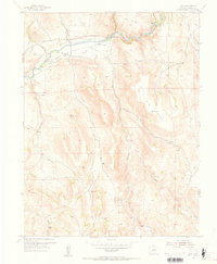
1954 Map of Iola
USGS Topo · Published 1955About this map
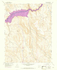
The Gunnison River corridor serves as the primary artery for settlement and irrigation in this mid-century Western Colorado landscape. Small communities like Iola and Hierro are positioned along the riverbank and an abandoned rail line, reflecting a reliance on the narrow valley for transport and agriculture. The reliance on water is further evidenced by the extensive network of ditch and flume systems designed to divert river water to nearby fields. Moving south from the river, the terrain rises sharply into the high country of Big Mesa, where the landscape is defined by drainage systems such as Willow Creek and Sage Creek. The map records specific cattle-country landmarks like Shaw Ranch and remote geographic points such as Blaine Rock, documenting the transition from valley floor settlements to the high grazing lands of the Gunnison and Saguache county border.
Find a feature on this map
24 named features on this map. Tap any name to fly to it.
Don’t see what you’re looking for? This feature index may not catch every label — zoom into the map to look around manually.
Map Details
Editions of this 1954 Iola Map
8 editions found
Other maps of this area

1908 · Uncompahgre
USGS Topo · 1:125,000

1911 · Uncompahgre
USGS Topo · 1:125,000

1954 · Iris NW
USGS Topo · 1:24,000

1954 · Iola
USGS Topo · 1:24,000

1954 · Mc Intosh Mountain
USGS Topo · 1:24,000

1954 · West Elk Peak SW
USGS Topo · 1:24,000

1954 · Gunnison
USGS Topo · 1:24,000

1954 · Cebolla
USGS Topo · 1:24,000

1954 · Gateview
USGS Topo · 1:24,000

1956 · Montrose
USGS Topo · 1:250,000