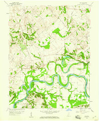
1958 Map of Iona
USGS Topo · Published 1959About this map
The White River carves a complex, winding path through this 1958 survey, defining the boundaries where Knox, Gibson, and Pike counties meet. The landscape is a study in river-bottom geography, where oxbows and standing water like Half Moon Pond and Ten Acre Pond flank the main channel. Away from the alluvial plains, the land rises into a patchwork of rural holdings marked by small community centers and an emerging petroleum economy, evidenced by the numerous Oil Wells scattered through Harrison and Clay townships. Local identity is anchored by several country churches and family burial grounds, including Trinity Ch, Hermon Ch, and the Old Fellows Cem. Small settlements such as Iona, Ridgeville, and Giro serve as the primary nodes for this agricultural and extractive landscape, connected by a network of drainage features like Deshee Ditch and Muddy Run.
Find a feature on this map
36 named features on this map. Tap any name to fly to it.
Don’t see what you’re looking for? This feature index may not catch every label — zoom into the map to look around manually.
Map Details
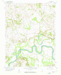
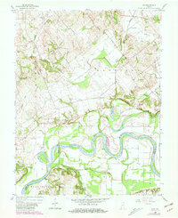
Editions of this 1958 Iona Map
3 editions found
Other maps of this area

1901 · Princeton
USGS Topo · 1:62,500

1902 · Ditney
USGS Topo · 1:125,000

1903 · Petersburg
USGS Topo · 1:62,500

1903 · Princeton
USGS Topo · 1:62,500

1903 · Patoka
USGS Topo · 1:125,000

1915 · Vincennes
USGS Topo · 1:62,500

1942 · Fritchton
USGS Topo · 1:24,000

1944 · Fritchton
USGS Topo · 1:24,000

1944 · Monroe City
USGS Topo · 1:24,000

1944 · Wheatland
USGS Topo · 1:24,000