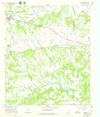
1956 Map of Iredell
USGS Topo · Published 1979About this map
The town of Iredell serves as the focal point of this Bosque County landscape, situated along the North Bosque River. The map highlights a community shaped by its topographical transitions, from the river valley to the prominent height of Johnson Peak. Evidence of early transportation infrastructure is visible in the Old Railroad Grade that skirts the northern edge of the settlement. To the south, the terrain becomes more dissected as Spring Creek and Gibson Branch flow through the hills. This 1956 survey, updated in the late 1970s, captures essential local landmarks for genealogists, including the New Iredell Cem and the Spring Creek Ch. Small-scale industrial activity is noted at the Caliche Pit, reflecting the area's reliance on local geological resources for road building and construction.
Find a feature on this map
11 named features on this map. Tap any name to fly to it.
Don’t see what you’re looking for? This feature index may not catch every label — zoom into the map to look around manually.
Map Details
Editions of this 1956 Iredell Map
2 editions found
Other maps of this area

1888 · Meridian
USGS Topo · 1:125,000

1889 · Granbury
USGS Topo · 1:125,000

1894 · Meridian
USGS Topo · 1:125,000

1931 · Morgan
USGS Topo · 1:62,500

1954 · Dallas
USGS Topo · 1:250,000

1954 · Waco
USGS Topo · 1:250,000

1955 · Waco
USGS Topo · 1:250,000

1955 · Meridian
USGS Topo · 1:24,000

1956 · Cranfills Gap
USGS Topo · 1:24,000
1956 · Fairy
USGS Topo · 1:24,000