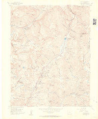
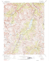
1955 Map of Ironton
USGS Topo · Published 1960About this map
Mining operations and high-altitude transport define this mid-century survey of the San Juan Mountains. The landscape is dominated by the industrial legacy of the Silverton and Ouray districts, where the Million Dollar Highway winds past concentrated clusters of extraction sites. Dense mining activity is visible at settlements like Ironton, Guston, and Camp Bird, supported by an extensive network of pack trails and jeep trails that navigate the steep basins.
Find a feature on this map
143 named features on this map. Tap any name to fly to it.
Don’t see what you’re looking for? This feature index may not catch every label — zoom into the map to look around manually.
Map Details
Editions of this 1955 Ironton Map
5 editions found
Other maps of this area

1897 · Telluride
USGS Topo · 1:62,500

1897 · Silverton
USGS Topo · 1:62,500

1901 · Silverton
USGS Topo · 1:62,500

1902 · Silverton
USGS Topo · 1:62,500

1902 · Ouray
USGS Topo · 1:62,500

1904 · Ouray
USGS Topo · 1:62,500

1904 · Telluride
USGS Topo · 1:62,500

1909 · Montrose
USGS Topo · 1:125,000

1911 · Montrose
USGS Topo · 1:125,000

1945 · Durango
USGS Topo · 1:250,000