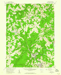
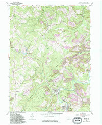
1959 Map of Irvona
USGS Topo · Published 1960About this map
The heavy-industrial character of the Clearfield County highlands is evident in the numerous strip mines and transport networks following the winding course of Clearfield Creek. Rail commerce centers on the borough of Irvona, where the Pennsylvania and New York Central lines converge, serving the surrounding mining communities of Coalport, Blain City, and Rosebud. This era of development shows a landscape transitioning between agricultural roots and intensive resource extraction, with family-named landmarks like McPherron, Diehltown, and Berwinsdale scattered among the wooded ridges.
Find a feature on this map
68 named features on this map. Tap any name to fly to it.
Don’t see what you’re looking for? This feature index may not catch every label — zoom into the map to look around manually.
Map Details
Editions of this 1959 Irvona Map
5 editions found
Other maps of this area

1902 · Patton
USGS Topo · 1:62,500

1903 · Curwensville
USGS Topo · 1:62,500

1903 · Houtzdale
USGS Topo · 1:62,500

1904 · Patton
USGS Topo · 1:62,500

1905 · Houtzdale
USGS Topo · 1:62,500

1920 · Altoona
USGS Topo · 1:62,500

1922 · Altoona
USGS Topo · 1:62,500

1939 · Curwensville
USGS Topo · 1:62,500

1942 · Curwensville
USGS Topo · 1:62,500

1943 · Punxsutawney
USGS Topo · 1:125,000