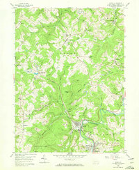
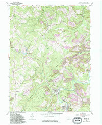
1959 Map of Irvona
USGS Topo · Published 1970About this map
Clearfield Creek winds through the southern portion of this Clearfield County landscape, anchoring the industrial and residential centers of Irvona and Coalport. The late 1950s terrain is heavily defined by the coal economy, with numerous strip mines scarring the ridges above settlements like Gazzam and Carnwath. This industrial footprint is balanced by significant public acreage in State Game Lands No 120 and long-standing rural community centers such as Fruit Hill Ch and Ansonville. Transportation routes are dictated by the narrow valleys, where the New York Central and Pennsylvania rail lines follow the water gaps to serve the mines. Smaller hamlets like Berwinsdale and Glen Hope appear as quiet clusters between the active extraction sites, while family history is preserved in locations like St Basil Cem and Zion Cem.
Find a feature on this map
65 named features on this map. Tap any name to fly to it.
Don’t see what you’re looking for? This feature index may not catch every label — zoom into the map to look around manually.
Map Details
Editions of this 1959 Irvona Map
5 editions found
Other maps of this area

1902 · Patton
USGS Topo · 1:62,500

1903 · Curwensville
USGS Topo · 1:62,500

1903 · Houtzdale
USGS Topo · 1:62,500

1904 · Patton
USGS Topo · 1:62,500

1905 · Houtzdale
USGS Topo · 1:62,500

1920 · Altoona
USGS Topo · 1:62,500

1922 · Altoona
USGS Topo · 1:62,500

1939 · Curwensville
USGS Topo · 1:62,500

1942 · Curwensville
USGS Topo · 1:62,500

1943 · Punxsutawney
USGS Topo · 1:125,000