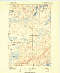
1950 Map of Isaac Lake
USGS Topo · Published 1950About this map
Minnesota State Forest lands and the edge of the Superior National Forest define this 1950 topography of the iron-rich northern timberlands. The landscape is dominated by the Mesaba Range rising in the south, where the Missabe and Iron Range railroad snakes through the hills to serve the region's industrial core. A network of glacial lakes including Isaac Lake, Kaunonen Lake, and Island Lake are scattered across the terrain, connected by the winding path of the Embarrass River. Local heritage is anchored by the Waasa area, where a lonely Town Hall and the Armanda Cem and Argo Cem suggest the small, community-centered settlements that persisted in the shadow of the great northern forests and iron mines.
Find a feature on this map
23 named features on this map. Tap any name to fly to it.
Don’t see what you’re looking for? This feature index may not catch every label — zoom into the map to look around manually.
Map Details
Editions of this 1950 Isaac Lake Map
2 editions found
Other maps of this area

1933 · Ely
USGS Topo · 1:62,500

1939 · Ely
USGS Topo · 1:62,500

1949 · Aurora
USGS Topo · 1:24,000

1949 · Isaac Lake
USGS Topo · 1:24,000

1949 · Allen
USGS Topo · 1:24,000

1949 · Embarrass
USGS Topo · 1:24,000

1950 · Isaac Lake
USGS Topo · 1:24,000

1950 · Embarrass
USGS Topo · 1:24,000

1950 · Allen
USGS Topo · 1:24,000

1950 · Aurora
USGS Topo · 1:24,000