
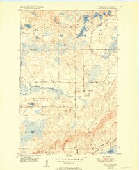
1950 Map of Isaac Lake
USGS Topo · Published 1950About this map
The Embarrass River and Birch River wind through this heavily forested section of St. Louis County, where the transition between the Minnesota State Forest and the Superior National Forest defines the landscape. The interior is characterized by a dense network of glacial lakes and wetlands, including Island Lake, Isaac Lake, and the uniquely named Sock Lake. This 1950 survey highlights the local infrastructure of the rural north woods, featuring the Duluth Missabe and Iron Range railroad cutting across the southern corner.
Find a feature on this map
21 named features on this map. Tap any name to fly to it.
Don’t see what you’re looking for? This feature index may not catch every label — zoom into the map to look around manually.
Map Details
Editions of this 1950 Isaac Lake Map
2 editions found
Other maps of this area

1933 · Ely
USGS Topo · 1:62,500

1939 · Ely
USGS Topo · 1:62,500

1949 · Aurora
USGS Topo · 1:24,000

1949 · Isaac Lake
USGS Topo · 1:24,000

1949 · Allen
USGS Topo · 1:24,000

1949 · Embarrass
USGS Topo · 1:24,000

1950 · Embarrass
USGS Topo · 1:24,000

1950 · Allen
USGS Topo · 1:24,000

1950 · Aurora
USGS Topo · 1:24,000

1951 · Babbitt SW
USGS Topo · 1:24,000