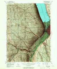
1949 Map of Ithaca West
USGS Topo · Published 1967About this map
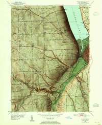
Cayuga Lake defines the eastern boundary of this mid-century landscape, where the city of Ithaca transitions from its urban core to the rural uplands of Ulysses and Enfield. The terrain is characterized by dramatic glens and falls, notably within Robert H Treman State Park where Lucifer Falls marks the rugged descent of Enfield Creek. Significant institutional landmarks from the 1940s are documented here, including the Biggs Memorial Hospital and the I O O F Orphanage overlooking the water. Transportation networks of the era are clearly visible, from the Lehigh Valley railroad lines hugging the shore to the historic Catskill Turnpike cutting westward across the hills. Genealogists and local historians can locate smaller community centers like Quaker Settlement and various family-named corners such as Kennedy Corner and Whipple Corner before postwar suburban expansion changed the character of the town's perimeter.
Find a feature on this map
76 named features on this map. Tap any name to fly to it.
Don’t see what you’re looking for? This feature index may not catch every label — zoom into the map to look around manually.
Map Details
Editions of this 1949 Ithaca West Map
5 editions found

Other maps of this area

1893 · Ithaca
USGS Topo · 1:62,500

1895 · Ithaca
USGS Topo · 1:62,500

1898 · Moravia
USGS Topo · 1:62,500

1900 · Dryden
USGS Topo · 1:62,500

1902 · Moravia
USGS Topo · 1:62,500

1902 · Genoa
USGS Topo · 1:62,500

1905 · Watkins Glen
USGS Topo · 1:125,000

1906 · Catatonk
USGS Topo · 1:125,000

1942 · Ludlowville
USGS Topo · 1:24,000

1942 · Trumansburg
USGS Topo · 1:24,000