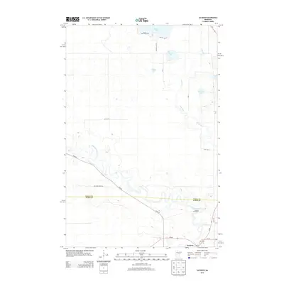
2013 Map of Jacobson
USGS Topo · Published 2013About this map
The Mississippi River snakes across this northern Minnesota landscape, forming a natural boundary that defines the settlement patterns of Jacobson. Located near the confluence of the Swan River, this area transitions from the river's winding oxbows into a dense network of glacial water bodies, including Shallow Lake, McGuire Lake, and Austin Lake. The village of Jacobson sits at the intersection of MN-65 and MN-200, serving as a vital junction for the surrounding timber and wetland regions.
Find a feature on this map
25 named features on this map. Tap any name to fly to it.
Don’t see what you’re looking for? This feature index may not catch every label — zoom into the map to look around manually.
Map Details
Editions of this 2013 Jacobson Map
This is the sole edition of this map. No revisions or reprints were ever made.
Other maps of this area

1953 · Duluth
USGS Topo · 1:250,000

1954 · Hibbing
USGS Topo · 1:250,000

1957 · Hibbing
USGS Topo · 1:250,000

1958 · Hibbing
USGS Topo · 1:250,000

1958 · Duluth
USGS Topo · 1:250,000

1964 · Hibbing
USGS Topo · 1:250,000

1969 · La Prairie
USGS Topo · 1:24,000
1969 · Goodland
USGS Topo · 1:24,000
1970 · Warba
USGS Topo · 1:24,000

1970 · Split Hand Lake
USGS Topo · 1:24,000