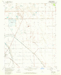
1963 Map of Jamesan
USGS Topo · Published 1965About this map
Tranquillity and the rail-stop at Jamesan anchor this section of the San Joaquin Valley during the early 1960s, a landscape defined by industrial agriculture and complex water management. The Southern Pacific railroad cuts through the terrain, connecting small rural hubs to the broader California economy. This era reveals a sophisticated irrigation and drainage network, highlighted by the massive James Bypass and the winding course of the Fresno Slough.
Find a feature on this map
35 named features on this map. Tap any name to fly to it.
Don’t see what you’re looking for? This feature index may not catch every label — zoom into the map to look around manually.
Map Details
Editions of this 1963 Jamesan Map
3 editions found
Other maps of this area

1921 · Mendota
USGS Topo · 1:31,680

1923 · Englebrecht Ranch
USGS Topo · 1:31,680

1923 · Biola
USGS Topo · 1:31,680

1924 · Jamesan
USGS Topo · 1:31,680

1924 · Tranquillity
USGS Topo · 1:31,680

1924 · Gravelly Ford
USGS Topo · 1:31,680

1924 · Mendota
USGS Topo · 1:31,680

1925 · Helm
USGS Topo · 1:31,680

1925 · San Joaquin
USGS Topo · 1:31,680

1946 · Tranquillity
USGS Topo · 1:62,500