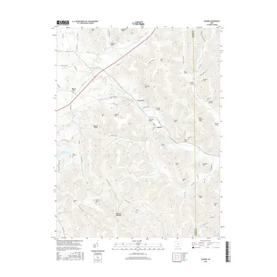
2016 Map of Jaybird
USGS Topo · Published 2016About this map
Mineral Springs and the village of Jaybird anchor this map of the border between Adams and Scioto Counties. The landscape is defined by the winding course of Scioto Brush Creek and its many tributaries, including Cedar Fork and Dunlap Creek. This terrain is deeply etched with hollows and ridges, such as Stone Quarry Ridge and Hackleshin Ridge, reflecting the complex geography of the foothills. Local family history is well-preserved through numerous burial sites, including the Peach Mountain Cemetery near Peach Mountain and the Aikens Cemetery tucked near Beech Fork. The road network, including Portsmouth Road and the Jaybird Road, connects small settlements like Bacon Flat and Pleasant Valley to the surrounding hills. Several high points like Tener Mountain and Mill Dam Hill overlook the narrow valleys where agriculture and community life have long been established.
Find a feature on this map
85 named features on this map. Tap any name to fly to it.
Don’t see what you’re looking for? This feature index may not catch every label — zoom into the map to look around manually.
Map Details
Editions of this 2016 Jaybird Map
This is the sole edition of this map. No revisions or reprints were ever made.
Other maps of this area

1915 · Bainbridge
USGS Topo · 1:48,000

1915 · Otway
USGS Topo · 1:62,500

1915 · Piketon
USGS Topo · 1:62,500

1916 · Peebles
USGS Topo · 1:62,500

1917 · Bainbridge
USGS Topo · 1:62,500

1917 · Piketon
USGS Topo · 1:62,500

1917 · Otway
USGS Topo · 1:62,500

1918 · Peebles
USGS Topo · 1:62,500

1944 · Piketon
USGS Topo · 1:62,500

1947 · Columbus
USGS Topo · 1:250,000