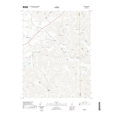
2019 Map of Jaybird
USGS Topo · Published 2019About this map
Mineral Springs and the surrounding southern Ohio uplands are defined by a complex network of ridges and hollows along the border of Adams and Scioto Counties. The terrain is marked by prominent elevations such as Peach Mtn and Tener Mtn, separated by deep drainages like Scioto Brush Creek and Beech Fork. This landscape supported small, dispersed communities at Jaybird, Bacon Flat, and Pleasant Valley. A deep connection to the land is visible through family and community burial sites, including Aikens Cem and Newman Cem, which are scattered throughout the hills. The presence of a Stone Quarry on Stone Quarry Ridge suggests a history of local stone extraction, while the Buckeye Trail indicates the area's modern role in conservation and recreation near the Beaver Pond.
Find a feature on this map
87 named features on this map. Tap any name to fly to it.
Don’t see what you’re looking for? This feature index may not catch every label — zoom into the map to look around manually.
Map Details
Editions of this 2019 Jaybird Map
This is the sole edition of this map. No revisions or reprints were ever made.
Other maps of this area

1915 · Bainbridge
USGS Topo · 1:48,000

1915 · Otway
USGS Topo · 1:62,500

1915 · Piketon
USGS Topo · 1:62,500

1916 · Peebles
USGS Topo · 1:62,500

1917 · Bainbridge
USGS Topo · 1:62,500

1917 · Piketon
USGS Topo · 1:62,500

1917 · Otway
USGS Topo · 1:62,500

1918 · Peebles
USGS Topo · 1:62,500

1944 · Piketon
USGS Topo · 1:62,500

1947 · Columbus
USGS Topo · 1:250,000