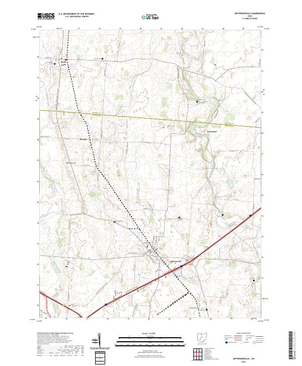
2023 Map of Jeffersonville
USGS Topo · Published 2023About this map
Jeffersonville serves as the primary hub of this agricultural landscape in Fayette Co, where the grid of modern transport meets early settlement patterns. This area is characterized by a high concentration of small family and community burial grounds, such as Hogue - Allen Cem and Booco - Ryan Cem, which provide significant value for genealogical research. The terrain is defined by the gentle drainage of Sugar Creek and Paint Creek, with Dumpling Hill rising as a localized landmark west of the small crossroads at Blessing. The map captures the county line where Madison Co meets Fayette, documenting the transition between rural townships and the village centers of South Solon and Bookwalter. The presence of Old Jeffersonville Cem and several others along the backroads highlights the long-standing community footprint in this part of Ohio.
Find a feature on this map
62 named features on this map. Tap any name to fly to it.
Don’t see what you’re looking for? This feature index may not catch every label — zoom into the map to look around manually.
Map Details
Editions of this 2023 Jeffersonville Map
This is the sole edition of this map. No revisions or reprints were ever made.
Other maps of this area

1906 · Mt Sterling
USGS Topo · 1:62,500

1907 · London
USGS Topo · 1:62,500

1907 · South Charleston
USGS Topo · 1:62,500

1916 · Octa
USGS Topo · 1:62,500

1944 · Octa
USGS Topo · 1:62,500

1947 · Columbus
USGS Topo · 1:250,000

1961 · Columbus
USGS Topo · 1:250,000
1961 · Florence
USGS Topo · 1:24,000
1961 · Walnut Run
USGS Topo · 1:24,000
1961 · Milledgeville
USGS Topo · 1:24,000