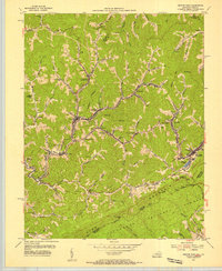
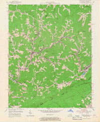
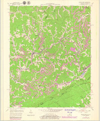
1954 Map of Jenkins West
USGS Topo · Published 1956About this map
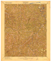
Neon and Fleming anchor this 1950s study of the coal-rich highlands along the Kentucky-Virginia border. The landscape is defined by the deep incisions of Rockhouse Creek and Elkhorn Creek, where narrow valleys host a dense network of mountain settlements like Hemphill (Jackhorn PO) and McRoberts. These communities are physically linked by the Chesapeake and Ohio and Louisville and Nashville railroads, which snake through the topography to serve the intensive extraction operations labeled as strip mines.
Find a feature on this map
78 named features on this map. Tap any name to fly to it.
Don’t see what you’re looking for? This feature index may not catch every label — zoom into the map to look around manually.
Map Details
Editions of this 1954 Jenkins West Map
3 editions found
Other maps of this area

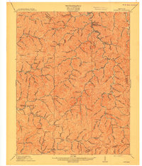
1890 · Whitesburg
USGS Topo · 1:125,000

1892 · Whitesburg
USGS Topo · 1:125,000

1912 · Pound
USGS Topo · 1:48,000

1912 · Hindman
USGS Topo · 1:48,000

1913 · Oven Fork
USGS Topo · 1:48,000

1914 · Pound
USGS Topo · 1:62,500

1914 · Vergie
USGS Topo · 1:48,000
1915 · Hindman
USGS Topo · 1:62,500

1915 · Whitesburg
USGS Topo · 1:62,500
1916 · Pikeville
USGS Topo · 1:62,500