
Loading...
Loading map...2023 Map of Jeromesville
USGS Topo · Published 2023About this map
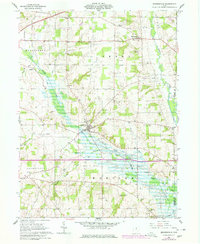
The Jerome Fork river valley anchors this part of north-central Ohio, where traditional agricultural patterns and local crossroads define the landscape. The village of Jeromesville serves as a central hub, accompanied by several nearby burial grounds including the Jeromesville Cem and Methodist Cem. These sites, along with the Old Rowsburg Cem further north, provide essential points of reference for genealogists tracking early families in the region.
Find a feature on this map
59 named features on this map. Tap any name to fly to it.
Don’t see what you’re looking for? This feature index may not catch every label — zoom into the map to look around manually.
Map Details
Date Portrayed2023
Date Published2023
PublisherU.S. Geological Survey
Map TypeTopographic
Scale1:24000
Physical Dimensions24 x 29 inches
Editions of this 2023 Jeromesville Map
This is the sole edition of this map. No revisions or reprints were ever made.
Historical Maps of Vermillion Township Through Time
Featured Locations
- Mohican Township, OH
- Perry Township, OH
- Chester Township, OH
- Plain Township, OH
- Jeromesville, Mohican Township
Source Details
SourceU.S. Geological Survey
CopyrightPublic Domain