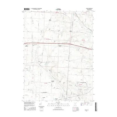
2016 Map of Jersey
USGS Topo · Published 2016About this map
Jersey and the northern outskirts of Pataskala anchor this part of Licking County, where the transition from traditional rural crossroad settlements to modern residential developments is evident. Local history is deeply rooted in the landscape, marked by numerous burial grounds including the Jersey Presbyterian Cem, Jersey Universalist Cem, and Wickliff Cem. The area is characterized by many small hamlets and named intersections such as Millers Corners, Tylers Corners, and Panhandle Corners, reflecting a settlement pattern established long before the suburban expansion seen at Beechwood Trails. The S Fork Licking River and its various tributaries like Blacklick Cr and Raccoon Creek drainage provide the natural framework for the terrain. Land use here shows a mix of older section-line roads like Jug Street Rd NW and Morse Rd SW alongside newer subdivisions and community centers like Columbia Center.
Find a feature on this map
102 named features on this map. Tap any name to fly to it.
Don’t see what you’re looking for? This feature index may not catch every label — zoom into the map to look around manually.
Map Details
Editions of this 2016 Jersey Map
This is the sole edition of this map. No revisions or reprints were ever made.
Other maps of this area

1902 · Westerville
USGS Topo · 1:62,500

1904 · Westerville
USGS Topo · 1:62,500

1907 · Thurston
USGS Topo · 1:62,500

1908 · Granville
USGS Topo · 1:62,500

1909 · Thurston
USGS Topo · 1:62,500

1910 · Granville
USGS Topo · 1:62,500

1925 · East Columbus
USGS Topo · 1:62,500

1943 · East Columbus
USGS Topo · 1:62,500

1947 · Columbus
USGS Topo · 1:250,000

1950 · Marion
USGS Topo · 1:250,000