Loading...
Loading map...2023 Map of Jersey
USGS Topo · Published 2023About this map
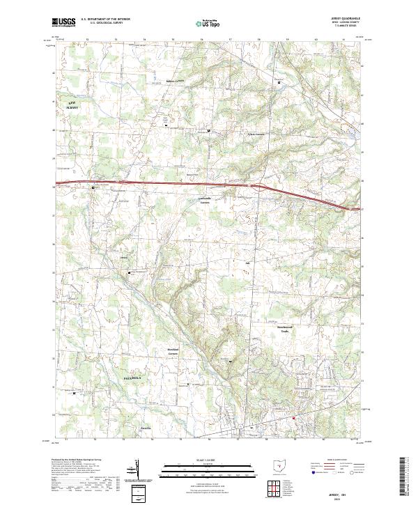
South Fork Licking River winds through this section of Licking County, defining a landscape marked by longstanding rural crossroads and expanding suburban reaches. The settlement of Jersey serves as a central point, flanked by smaller historic junctions such as Panhandle Corners, Millers Corners, and Tylers Corners. These points reflect a classic Ohio township structure, where small clusters of homes and commerce anchored local agricultural life.
Find a feature on this map
141 named features on this map. Tap any name to fly to it.
Don’t see what you’re looking for? This feature index may not catch every label — zoom into the map to look around manually.
Map Details
Date Portrayed2023
Date Published2023
PublisherU.S. Geological Survey
Map TypeTopographic
Scale1:24000
Physical Dimensions24 x 29 inches
Editions of this 2023 Jersey Map
This is the sole edition of this map. No revisions or reprints were ever made.
Historical Maps of Jersey Through Time
Featured Locations
Source Details
SourceU.S. Geological Survey
CopyrightPublic Domain