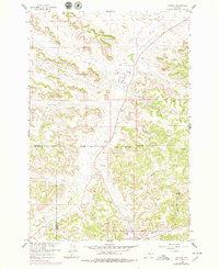
1958 Map of Jimtown
USGS Topo · Published 1979About this map
Jimtown serves as the focal point for this 1950s survey of the Montana landscape, situated near the Northern Cheyenne Indian Reservation Boundary. The terrain is defined by the winding course of Rosebud Creek and its many tributaries, including Little Cottonwood Creek and Lame Deer Creek. The settlement pattern is sparse, dominated by established homesteads like McKay Ranch and Bailey Ranch, which reflect the ranching economy of the Rosebud and Big Horn county borderlands.
Find a feature on this map
22 named features on this map. Tap any name to fly to it.
Don’t see what you’re looking for? This feature index may not catch every label — zoom into the map to look around manually.
Map Details
Editions of this 1958 Jimtown Map
2 editions found
Other maps of this area

1954 · Hardin
USGS Topo · 1:250,000

1957 · Hardin
USGS Topo · 1:250,000

1958 · Hardin
USGS Topo · 1:250,000

1958 · Painted Hill
USGS Topo · 1:24,000

1958 · Jimtown
USGS Topo · 1:24,000

1958 · Black Spring
USGS Topo · 1:24,000

1958 · Fisher Butte
USGS Topo · 1:24,000

1958 · Lame Deer
USGS Topo · 1:24,000

1958 · Badger Peak
USGS Topo · 1:24,000

1971 · Colstrip SW
USGS Topo · 1:24,000