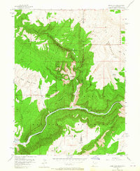
1955 Map of Jones Hole
USGS Topo · Published 1965About this map
Dinosaur National Monument straddles the border of Utah and Colorado in this mid-century topographic study, capturing the intersection of the Whirlpool Canyon Green River and the deeply carved canyons of the Uintah Mountains. Remote outposts like the Jones Hole Ranger Station and Snow Ranch highlight the isolated nature of this high-desert landscape during the 1950s. The terrain is defined by dramatic elevation changes from Diamond Mountain down to the Jones Hole Creek, where several perennial sources like Jones Hole Springs and Burnt Springs emerge. The presence of the Gaging Sta along the river and the primitive Jones Hole Trail suggest the area's primary use for conservation and water management. For those interested in regional history, the map preserves the location of family operations like Chew Ranch and landmarks such as Harpers Corner before increased modern tourism altered the accessibility of these canyons.
Find a feature on this map
35 named features on this map. Tap any name to fly to it.
Don’t see what you’re looking for? This feature index may not catch every label — zoom into the map to look around manually.
Map Details
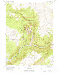
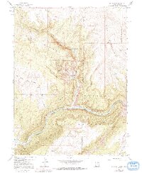
Editions of this 1955 Jones Hole Map
4 editions found

Other maps of this area

1885 · Ashley
USGS Topo · 1:250,000

1907 · Rangely
USGS Topo · 1:125,000

1907 · Jensen
USGS Topo · 1:125,000

1910 · Jensen
USGS Topo · 1:125,000

1910 · Rangely
USGS Topo · 1:125,000

1954 · Hells Canyon
USGS Topo · 1:24,000

1954 · Canyon of Lodore South
USGS Topo · 1:24,000

1954 · Canyon of Lodore North
USGS Topo · 1:24,000

1954 · Vernal
USGS Topo · 1:250,000

1955 · Island Park
USGS Topo · 1:24,000