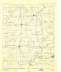
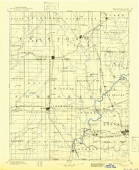
1894 Map of Joplin
USGS Topo · Published 1913About this map
Mining and rail activity dominate this 1884 survey of the borderlands where Kansas meets Missouri and Indian Territory. The burgeoning industrial hub of Pittsburg serves as a central node for a dense network of lines, including the Kansas City and Southern Railroad and the St. Louis and San Francisco Railroad. To the south, the tri-state mining district comes into focus around Galena and the edge of Joplin, where the landscape is carved by Shoal Creek and Shawnee Creek. The map documents numerous smaller coal and zinc-related settlements such as Frontenac, Scammon, and Weir, many of which were established specifically to support the region's mineral extraction. Along the southern edge, the Boundary Line for Kansas Indian Territory marks a significant political transition, while agricultural townships like Garden and Spring Valley provide a rural counterpoint to the busy rail corridors and mining camps.
Find a feature on this map
103 named features on this map. Tap any name to fly to it.
Don’t see what you’re looking for? This feature index may not catch every label — zoom into the map to look around manually.
Map Details
Editions of this 1894 Joplin Map
6 editions found

Other maps of this area

1884 · Fort Scott
USGS Topo · 1:125,000

1886 · Nevada
USGS Topo · 1:125,000

1886 · Joplin
USGS Topo · 1:125,000

1886 · Iola
USGS Topo · 1:125,000

1886 · Fort Scott
USGS Topo · 1:125,000

1886 · Carthage
USGS Topo · 1:125,000

1886 · Parsons
USGS Topo · 1:125,000

1893 · Fort Scott
USGS Topo · 1:125,000

1893 · Iola
USGS Topo · 1:125,000

1893 · Parsons
USGS Topo · 1:125,000