
1943 Map of Juliff
USGS Topo · Published 1943About this map
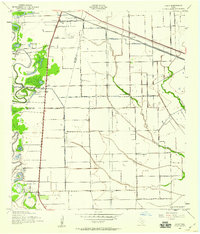
Darrington State Farm dominates the central landscape of this 1943 survey, showing the extensive agricultural operations and a dedicated Prison Cem near the banks of Oyster Creek. The agricultural and drainage patterns of this coastal prairie region are highly evident, shaped by the massive Briscoe Canal and numerous pumping stations that managed water for rice farming and other crops. Small rural hubs such as Juliff and Sandy Point serve as focal points along the Missouri Pacific railroad, while Iowa Colony appears as a structured settlement to the east.
Find a feature on this map
39 named features on this map. Tap any name to fly to it.
Don’t see what you’re looking for? This feature index may not catch every label — zoom into the map to look around manually.
Map Details
Editions of this 1943 Juliff Map
2 editions found
Other maps of this area

1920 · Mykawa
USGS Topo · 1:31,680

1920 · Almeda
USGS Topo · 1:31,680

1943 · Rosharon
USGS Topo · 1:31,680

1943 · Chocolate Bayou
USGS Topo · 1:24,000

1950 · Houston
USGS Topo · 1:250,000

1953 · Otey
USGS Topo · 1:24,000

1953 · Thompsons
USGS Topo · 1:24,000
1955 · Pearland
USGS Topo · 1:24,000
1955 · Almeda
USGS Topo · 1:24,000

1955 · Sugar Land
USGS Topo · 1:62,500