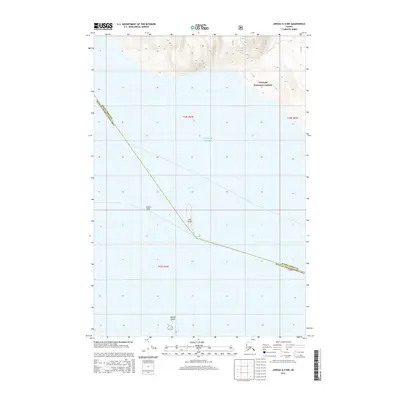
2015 Map of Juneau A-4 NW
USGS Topo · Published 2015About this map
Tongass National Forest meets the northern waters of Southeast Alaska in this maritime-focused survey. The map centers on the navigational landscape of Icy Strait and the Gulf of Alaska, where the shoreline is defined by hazardous marine features. Small landmasses and submerged dangers such as The Sisters, Sisters Reef, and Spasski Island dot the waterway, marking a critical corridor for regional transit and fishing.
Find a feature on this map
12 named features on this map. Tap any name to fly to it.
Don’t see what you’re looking for? This feature index may not catch every label — zoom into the map to look around manually.
Map Details
Editions of this 2015 Juneau A-4 NW Map
This is the sole edition of this map. No revisions or reprints were ever made.
Other maps of this area

1948 · Juneau B-4
USGS Topo · 1:63,360

1948 · Juneau A-4
USGS Topo · 1:63,360

1948 · Juneau B-5
USGS Topo · 1:63,360

1949 · Juneau B-4
USGS Topo · 1:63,360

1950 · Juneau B-5
USGS Topo · 1:63,360

1951 · Juneau
USGS Topo · 1:250,000

1951 · Juneau A-5
USGS Topo · 1:63,360

1962 · Juneau
USGS Topo · 1:250,000
1994 · Juneau A-5
USGS Topo · 1:63,360
1995 · Juneau A-4
USGS Topo · 1:63,360