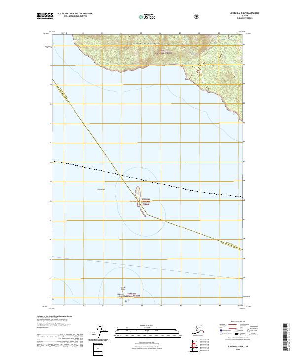
2021 Map of Juneau A-4 NW
USGS Topo · Published 2021About this map
The Saint Elias Mountains meet the northern waters of Icy Strait in this coastal Alaskan landscape, where the shoreline of the Tongass National Forest is marked by indigenous place names including Lulxágu and Gí-x X'aagá-k'u. This maritime environment is defined by its navigational hazards and small landforms, most notably the island group known as The Sisters and the nearby Sisters Reef. Further south in the strait, Spasski Island and the feature Yaana.eit Xágu stand as isolated points in the open water. The map records the intersection of the Haines Borough and Hoonah-Angoon Census Area, documenting the precise boundary line as it cuts across the maritime passage between the mainland and these offshore islands.
Find a feature on this map
15 named features on this map. Tap any name to fly to it.
Don’t see what you’re looking for? This feature index may not catch every label — zoom into the map to look around manually.
Map Details
Editions of this 2021 Juneau A-4 NW Map
This is the sole edition of this map. No revisions or reprints were ever made.
Other maps of this area

1948 · Juneau B-4
USGS Topo · 1:63,360

1948 · Juneau A-4
USGS Topo · 1:63,360

1948 · Juneau B-5
USGS Topo · 1:63,360

1949 · Juneau B-4
USGS Topo · 1:63,360

1950 · Juneau B-5
USGS Topo · 1:63,360

1951 · Juneau
USGS Topo · 1:250,000

1951 · Juneau A-5
USGS Topo · 1:63,360

1962 · Juneau
USGS Topo · 1:250,000
1994 · Juneau A-5
USGS Topo · 1:63,360
1995 · Juneau A-4
USGS Topo · 1:63,360