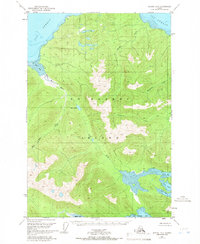
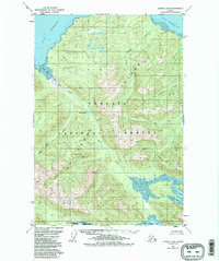
1951 Map of Juneau A-6
USGS Topo · Published 1966About this map
Chichagof Island is documented here during the early 1950s, showing a landscape defined by deep fjords and dense coastal forests within the Tongass National Forest. The topography is shaped by the Mud Bay River and Neka River, which drain into the saltwater of Icy Strait and Neka Bay. While the area is largely uninhabited, the presence of a single Cabin at the head of the bay suggests the seasonal activities of trappers or fishers common in the Alaskan Panhandle at this time. The interior remains dominated by glacial lakes like Otter Lake and the branching waters of the North Bight and South Bight. The map serves as a record of these unsurveyed lands before significant modern development, focusing on the natural water systems such as Chicken Creek and Gallagher Creek that dictate the island's geography.
Find a feature on this map
15 named features on this map. Tap any name to fly to it.
Don’t see what you’re looking for? This feature index may not catch every label — zoom into the map to look around manually.
Map Details
Editions of this 1951 Juneau A-6 Map
6 editions found
Other maps of this area

1948 · Juneau B-6
USGS Topo · 1:63,360

1948 · Juneau B-5
USGS Topo · 1:63,360

1948 · Sitka D-5
USGS Topo · 1:63,360

1948 · Mount Fairweather B-1
USGS Topo · 1:63,360

1948 · Sitka D-6
USGS Topo · 1:63,360

1948 · Mount Fairweather A-1
USGS Topo · 1:63,360

1950 · Juneau B-5
USGS Topo · 1:63,360

1951 · Juneau
USGS Topo · 1:250,000

1951 · Juneau A-6
USGS Topo · 1:63,360

1951 · Juneau A-5
USGS Topo · 1:63,360