
1962 Map of Juneau B-2
USGS Topo · Published 1963About this map
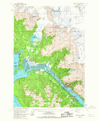
Juneau and Douglas anchor this early 1960s study of the Gastineau Channel, a landscape where industrial mining history meets the ice of the Mendenhall Glacier. The map highlights the area's massive gold mining heritage, specifically the Alaska Juneau Adit and the deep excavation known as The Glory Hole on Mt. Roberts, alongside the Treadwell Foundation across the water. The transition from industrial extraction to modern infrastructure is visible in the development of the Juneau Airport and the residential growth of Mendenhaven and West Juneau.
Find a feature on this map
53 named features on this map. Tap any name to fly to it.
Don’t see what you’re looking for? This feature index may not catch every label — zoom into the map to look around manually.
Map Details
Editions of this 1962 Juneau B-2 Map
4 editions found
Other maps of this area

1947 · Juneau B-3
USGS Topo · 1:63,360

1947 · Juneau B-2
USGS Topo · 1:63,360

1948 · Juneau A-3
USGS Topo · 1:63,360

1948 · Juneau B-1
USGS Topo · 1:63,360

1949 · Juneau B-3
USGS Topo · 1:62,500

1949 · Juneau B-2
USGS Topo · 1:62,500

1950 · Juneau A-3
USGS Topo · 1:63,360

1951 · Juneau
USGS Topo · 1:250,000

1951 · Juneau A-2
USGS Topo · 1:63,360

1951 · Juneau A-1
USGS Topo · 1:63,360