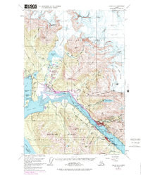
1962 Map of Juneau B-2
USGS Topo · Published 1978About this map
Gastineau Channel serves as the central artery for this mid-century Alaskan landscape, separating the mainland settlements of Juneau and West Juneau from Douglas Island. The map documents a period of significant growth, with purple revisions highlighting the expansion of urban areas into Mendenhaven and near the Juneau Airport. Industrial history is etched into the terrain, particularly in the mountain basins behind the city where the Ebner Falls Adit and The Glory Hole represent the region's hard-rock mining legacy.
Find a feature on this map
101 named features on this map. Tap any name to fly to it.
Don’t see what you’re looking for? This feature index may not catch every label — zoom into the map to look around manually.
Map Details
Editions of this 1962 Juneau B-2 Map
4 editions found

Other maps of this area

1947 · Juneau B-3
USGS Topo · 1:63,360

1947 · Juneau B-2
USGS Topo · 1:63,360

1948 · Juneau A-3
USGS Topo · 1:63,360

1948 · Juneau B-1
USGS Topo · 1:63,360

1949 · Juneau B-3
USGS Topo · 1:62,500

1949 · Juneau B-2
USGS Topo · 1:62,500

1950 · Juneau A-3
USGS Topo · 1:63,360

1951 · Juneau
USGS Topo · 1:250,000

1951 · Juneau A-2
USGS Topo · 1:63,360

1951 · Juneau A-1
USGS Topo · 1:63,360