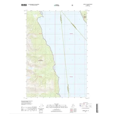
2017 Map of Juneau B-4 NE
USGS Topo · Published 2017About this map
The coastal wilderness of the Tongass National Forest dominates this section of Southeast Alaska, where steep forested slopes descend directly into the waters of the Lynn Canal. This 2017 survey documents a complex intersection of administrative boundaries, as the Haines Borough, Juneau Borough, and Hoonah-Angoon Census Area all meet within these maritime reaches. The landscape is defined by its deep fjords and isolated landmasses, including a portion of Lincoln Island situated at the northeastern edge of the sheet. The absence of roads or permanent settlements highlights the protected and undeveloped character of the forest service lands, preserving a snapshot of the region's natural geography as it exists in the early 21st century.
Find a feature on this map
9 named features on this map. Tap any name to fly to it.
Don’t see what you’re looking for? This feature index may not catch every label — zoom into the map to look around manually.
Map Details
Editions of this 2017 Juneau B-4 NE Map
This is the sole edition of this map. No revisions or reprints were ever made.
Other maps of this area

1947 · Juneau B-3
USGS Topo · 1:63,360

1948 · Juneau B-4
USGS Topo · 1:63,360

1948 · Juneau C-4
USGS Topo · 1:63,360

1949 · Juneau B-3
USGS Topo · 1:62,500

1949 · Juneau C-4
USGS Topo · 1:63,360

1949 · Juneau B-4
USGS Topo · 1:63,360

1951 · Juneau
USGS Topo · 1:250,000

1951 · Juneau C-3
USGS Topo · 1:63,360

1952 · Juneau C-3
USGS Topo · 1:63,360

1962 · Juneau B-3
USGS Topo · 1:63,360