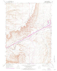
1961 Map of Kanda
USGS Topo · Published 1978About this map
White Mountain dominates this portion of Sweetwater County, rising sharply above the desert landscape where the Union Pacific rail line and the historic Overland Trail parallel one another. The drainage of Bitter Creek and its tributary, Little Bitter Creek, serves as the primary corridor for transportation and infrastructure, including a prominent Pipeline and Telephone lines. Small pockets of human activity appear in the vicinity of Kanda and the northern settlement of Greens, the latter situated near the mouth of Greens Canyon. The industrial and social layers of the late twentieth century are evident through features such as a Gravel Pit, a Radio Facility, and a Racetrack, reflecting the area's development as an energy and transit hub.
Find a feature on this map
15 named features on this map. Tap any name to fly to it.
Don’t see what you’re looking for? This feature index may not catch every label — zoom into the map to look around manually.
Map Details
Editions of this 1961 Kanda Map
2 editions found
Other maps of this area

1908 · Rock Springs
USGS Topo · 1:62,500

1910 · Rock Springs
USGS Topo · 1:62,500

1954 · Rock Springs
USGS Topo · 1:250,000

1957 · Firehole Basin
USGS Topo · 1:62,500

1958 · Rock Springs
USGS Topo · 1:250,000

1961 · Scott Spring
USGS Topo · 1:24,000

1961 · Pilot Butte
USGS Topo · 1:24,000

1961 · Kanda
USGS Topo · 1:24,000

1961 · Green River
USGS Topo · 1:24,000

1962 · Rock Springs
USGS Topo · 1:250,000