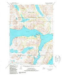
1952 Map of Karluk A-1
USGS Topo · Published 1988About this map
Kodiak Island's southern interior and shoreline reveal a landscape of interconnected water bodies and early industrial outposts in the early 1950s. Centered on the sprawling Olga Bay, this map highlights a crucial node for the region's salmon economy, featuring a Cannery and a dedicated Seaplane Base at Cannery Cove. These points of human activity are isolated within the extensive Kodiak National Wildlife Refuge, where transport depended entirely on the water and air.
Find a feature on this map
32 named features on this map. Tap any name to fly to it.
Don’t see what you’re looking for? This feature index may not catch every label — zoom into the map to look around manually.
Map Details
Editions of this 1952 Karluk A-1 Map
3 editions found

Other maps of this area

1951 · Kaguyak
USGS Topo · 1:250,000

1951 · Trinity Islands
USGS Topo · 1:250,000

1951 · Karluk
USGS Topo · 1:250,000

1952 · Kodiak
USGS Topo · 1:250,000

1952 · Kaguyak
USGS Topo · 1:250,000

1952 · Karluk
USGS Topo · 1:250,000

1952 · Trinity Islands D-2
USGS Topo · 1:63,360

1952 · Karluk B-2
USGS Topo · 1:63,360

1952 · Kodiak B-6
USGS Topo · 1:63,360

1952 · Karluk B-1
USGS Topo · 1:63,360