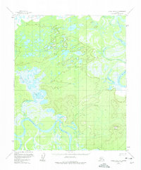
1954 Map of Kateel River C-2
USGS Topo · Published 1974About this map
The Koyukuk River dominates this interior landscape, winding in broad meanders through an intricate system of oxbows and floodplains. Captured during the mid-1950s, the terrain is characterized by its hydrologic complexity, where the Huslia River and Dagitli River feed into a network of wetlands and named water bodies such as Peter Cleaver Lake and Tsedolalindin Lake. A lone Winter Trail provides the only mapped evidence of overland travel, cutting through the lowlands west of the river. To the southeast, the topography rises significantly toward the prominent Roundabout Mountain, which stands as a clear navigational landmark above the surrounding flats. The intricate labeling of Louie Creek and smaller basins like Moldy Lake reflects the importance of specific water features for orientation in a region without permanent settlements or established roads.
Find a feature on this map
11 named features on this map. Tap any name to fly to it.
Don’t see what you’re looking for? This feature index may not catch every label — zoom into the map to look around manually.
Map Details
Editions of this 1954 Kateel River C-2 Map
2 editions found
Other maps of this area

1951 · Kateel River
USGS Topo · 1:250,000

1952 · Kateel River B-1
USGS Topo · 1:63,360

1952 · Kateel River B-3
USGS Topo · 1:63,360

1952 · Kateel River B-2
USGS Topo · 1:63,360

1954 · Kateel River C-2
USGS Topo · 1:63,360

1954 · Kateel River C-1
USGS Topo · 1:63,360

1954 · Kateel River D-1
USGS Topo · 1:63,360

1954 · Kateel River C-3
USGS Topo · 1:63,360

1954 · Kateel River D-3
USGS Topo · 1:63,360

1955 · Kateel River D-2
USGS Topo · 1:63,360