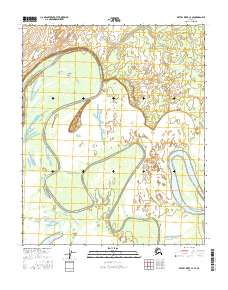
2016 Map of Kateel River C-3 SE
USGS Topo · Published 2016About this map
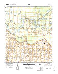
Three-Day-Slough dominates this remote Alaskan landscape, winding through a complex network of wetlands and meanders. The slough's intricate path illustrates the dynamic hydrology of the region, where water levels and shifting channels are the primary architects of the terrain. To the south, Tachanlowa Lake sits within a low-lying basin, while the Koyukuk River cuts through the southeastern corner of the survey. A prominent landform known as Colville Bend highlights a significant turn in the waterway, marking a point of geological interest for those studying the fluvial processes of the Yukon-Koyukuk interior. This 2016 survey documents the precise configuration of these vital water bodies before the inevitable shifts caused by seasonal flooding and permafrost changes.
Find a feature on this map
10 named features on this map. Tap any name to fly to it.
Don’t see what you’re looking for? This feature index may not catch every label — zoom into the map to look around manually.
Map Details
Editions of this 2016 Kateel River C-3 SE Map
This is the sole edition of this map. No revisions or reprints were ever made.
Other maps of this area

1951 · Kateel River
USGS Topo · 1:250,000

1952 · Kateel River B-3
USGS Topo · 1:63,360

1952 · Kateel River B-2
USGS Topo · 1:63,360

1954 · Kateel River C-2
USGS Topo · 1:63,360

1954 · Kateel River C-3
USGS Topo · 1:63,360

1955 · Kateel River
USGS Topo · 1:250,000
2015 · Kateel River C-3 SW
USGS Topo · 1:25,000
2015 · Kateel River C-3 NW
USGS Topo · 1:25,000
2015 · Kateel River B-3 NW
USGS Topo · 1:25,000
2015 · Kateel River B-3 NE
USGS Topo · 1:25,000