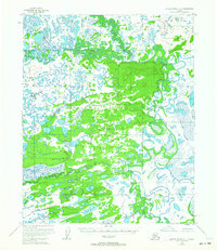
1955 Map of Kateel River D-2
USGS Topo · Published 1963About this map
The South Fork Kateel River winds through a complex network of wetlands and tundra in this mid-1950s survey of the interior Yukon-Koyukuk region. The landscape is defined by its shifting aquatic features, including the meandering Huslia River and prominent waterways like Nuna Slough and Ten Cook Slough. These interconnected channels and oxbows create a dynamic environment where water bodies such as Evan Lake and Moose Lake sit amidst vast stretches of marshland.
Find a feature on this map
9 named features on this map. Tap any name to fly to it.
Don’t see what you’re looking for? This feature index may not catch every label — zoom into the map to look around manually.
Map Details
Editions of this 1955 Kateel River D-2 Map
3 editions found
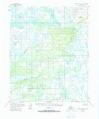
Other maps of this area

1951 · Shungnak
USGS Topo · 1:250,000

1951 · Kateel River
USGS Topo · 1:250,000

1954 · Kateel River C-2
USGS Topo · 1:63,360

1954 · Kateel River C-1
USGS Topo · 1:63,360

1954 · Kateel River D-1
USGS Topo · 1:63,360

1954 · Kateel River C-3
USGS Topo · 1:63,360

1954 · Kateel River D-3
USGS Topo · 1:63,360

1955 · Shungnak
USGS Topo · 1:250,000

1955 · Kateel River D-2
USGS Topo · 1:63,360

1955 · Kateel River
USGS Topo · 1:250,000