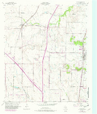
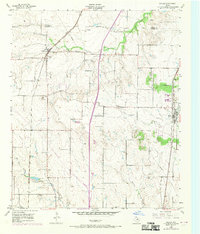
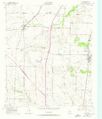
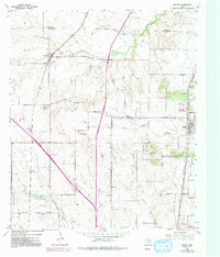
1955 Map of Keller
USGS Topo · Published 1981About this map
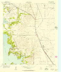
The Atchison Topeka and Santa Fe railroad serves as the primary corridor through this North Texas landscape, connecting the growing communities of Haslet and Keller. In the mid-1950s, the terrain was defined by a transition from agricultural use to early suburban development, particularly around Watauga. Small watercourses like Henrietta Creek and Big Fossil Creek drain the undulating prairie, while landmarks such as the FAA Facility on Blue Mound indicate the area's increasing importance to aviation and regional infrastructure. Genealogists and local historians will find the Sweets Chapel Cem in the northeast particularly significant for tracing early Tarrant County settlers. The map clearly delineates the Fort Worth Corporate Boundary, illustrating the city's northward expansion toward the Denton County line.
Find a feature on this map
27 named features on this map. Tap any name to fly to it.
Don’t see what you’re looking for? This feature index may not catch every label — zoom into the map to look around manually.
Map Details
Editions of this 1955 Keller Map
5 editions found
Other maps of this area

1894 · Fort Worth
USGS Topo · 1:125,000

1931 · Grapevine
USGS Topo · 1:62,500

1954 · Dallas
USGS Topo · 1:250,000

1954 · Sherman
USGS Topo · 1:250,000
1955 · Haltom City
USGS Topo · 1:24,000
1955 · Avondale
USGS Topo · 1:24,000
1955 · Keller
USGS Topo · 1:24,000
1955 · Lake Worth
USGS Topo · 1:24,000

1955 · Haltom City
USGS Topo · 1:62,500

1958 · Dallas
USGS Topo · 1:250,000