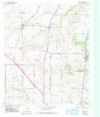
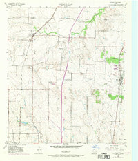
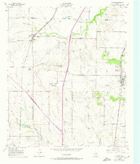
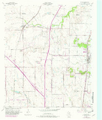
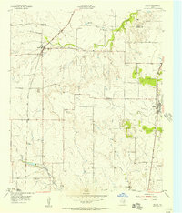
1955 Map of Keller
USGS Topo · Published 1992About this map
Haslet, Keller, and Watauga anchor this mid-century look at the North Texas landscape along the border of Denton and Tarrant Counties. The area is characterized by a mix of agricultural land and early suburban expansion, defined largely by the path of the Fort Worth and Denver RR and the development of major transit corridors like Interstate 35W. Specialized infrastructure, such as the Haslet Radio Beacon, a Landing Strip, and an FAA Facility, speaks to the region's historical ties to aviation and navigation during this era.
Find a feature on this map
27 named features on this map. Tap any name to fly to it.
Don’t see what you’re looking for? This feature index may not catch every label — zoom into the map to look around manually.
Map Details
Editions of this 1955 Keller Map
5 editions found
Other maps of this area

1894 · Fort Worth
USGS Topo · 1:125,000

1931 · Grapevine
USGS Topo · 1:62,500

1954 · Dallas
USGS Topo · 1:250,000

1954 · Sherman
USGS Topo · 1:250,000
1955 · Haltom City
USGS Topo · 1:24,000
1955 · Avondale
USGS Topo · 1:24,000
1955 · Keller
USGS Topo · 1:24,000
1955 · Lake Worth
USGS Topo · 1:24,000

1955 · Haltom City
USGS Topo · 1:62,500

1958 · Dallas
USGS Topo · 1:250,000