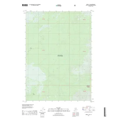
2017 Map of Kenai C-1 NE
USGS Topo · Published 2017About this map
Kenai National Wildlife Refuge and the Chugach National Forest dominate this section of the Kenai Peninsula, where the landscape is defined by the winding course of the Chickaloon River. This 2017 survey shows the convergence of protected wilderness and specialized infrastructure, most notably the South Gasline Airport located in the western portion of the quadrangle. The topography transitions from the river's drainage basins to more significant elevation in the east. The drainage network is further detailed by Thurman Cr, which feeds into the larger river system. This map provides a modern look at how the region's resource-related aviation infrastructure sits within expansive conservation boundaries, documenting the survey lines of t7n r4w and surrounding townships.
Find a feature on this map
12 named features on this map. Tap any name to fly to it.
Don’t see what you’re looking for? This feature index may not catch every label — zoom into the map to look around manually.
Map Details
Editions of this 2017 Kenai C-1 NE Map
This is the sole edition of this map. No revisions or reprints were ever made.
Other maps of this area

1944 · Kenai
USGS Topo · 1:250,000

1950 · Kenai
USGS Topo · 1:250,000

1951 · Seward
USGS Topo · 1:250,000

1951 · Kenai C-1
USGS Topo · 1:63,360

1951 · Kenai D-1
USGS Topo · 1:63,360

1951 · Seward C-8
USGS Topo · 1:63,360

1951 · Seward D-8
USGS Topo · 1:63,360

1952 · Kenai C-1
USGS Topo · 1:63,360

1952 · Seward D-8
USGS Topo · 1:63,360

1952 · Seward C-8
USGS Topo · 1:63,360