
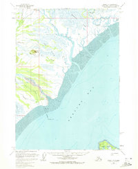
1958 Map of Kenai C-6
USGS Topo · Published 1963About this map
Redoubt Bay dominates this mid-century coastal survey, where the massive tidal action of the Cook Inlet region defines the landscape. The western shoreline is a complex network of glacial runoff and silty drainage, characterized by the expansive Bachatna Flats and Fox Flats. Large river systems like the Drift River and Big River terminate here, spilling into broad Tidal Flats that shift with the extreme Alaskan tides.
Find a feature on this map
17 named features on this map. Tap any name to fly to it.
Don’t see what you’re looking for? This feature index may not catch every label — zoom into the map to look around manually.
Map Details
Editions of this 1958 Kenai C-6 Map
2 editions found
Other maps of this area

1944 · Kenai
USGS Topo · 1:250,000

1950 · Kenai
USGS Topo · 1:250,000

1958 · Kenai B-7
USGS Topo · 1:63,360

1958 · Kenai C-5
USGS Topo · 1:63,360

1958 · Kenai D-5
USGS Topo · 1:63,360

1958 · Kenai D-6
USGS Topo · 1:63,360

1958 · Kenai D-7
USGS Topo · 1:63,360

1958 · Kenai C-7
USGS Topo · 1:63,360
1958 · Kenai B-6
USGS Topo · 1:63,360

1958 · Kenai
USGS Topo · 1:250,000