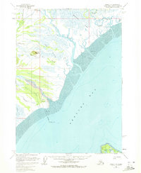
1958 Map of Kenai C-6
USGS Topo · Published 1972About this map
Redoubt Bay dominates this coastal survey, where the dynamic meeting of glacial rivers and tidal flats defines the Kenai Peninsula shoreline. Industrial infrastructure of the mid-20th century is evident at the Drift River Terminal, connected to a sub-sea Pipeline and supported by a nearby Landing Strip. The map captures a landscape of shifting waters and mudflats, where the Big River and Drift River discharge into the bay across vast marshy reaches like the Bachatna Flats and Fox Flats.
Find a feature on this map
24 named features on this map. Tap any name to fly to it.
Don’t see what you’re looking for? This feature index may not catch every label — zoom into the map to look around manually.
Map Details
Editions of this 1958 Kenai C-6 Map
2 editions found
Other maps of this area

1944 · Kenai
USGS Topo · 1:250,000

1950 · Kenai
USGS Topo · 1:250,000

1958 · Kenai B-7
USGS Topo · 1:63,360

1958 · Kenai C-5
USGS Topo · 1:63,360

1958 · Kenai D-5
USGS Topo · 1:63,360

1958 · Kenai C-6
USGS Topo · 1:63,360

1958 · Kenai D-6
USGS Topo · 1:63,360

1958 · Kenai D-7
USGS Topo · 1:63,360

1958 · Kenai C-7
USGS Topo · 1:63,360
1958 · Kenai B-6
USGS Topo · 1:63,360