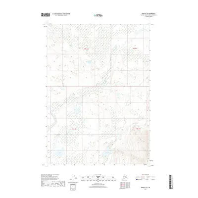
2017 Map of Kenai D-1 SE
USGS Topo · Published 2017About this map
Chickaloon River meanders through the wetlands and glacial depressions of the Kenai Peninsula, carving a path through a landscape defined by its complex hydrography. This 2017 survey by the U.S. Geological Survey captures a wild expanse of the Alaska interior where water dominates the geography. Clusters of distinct water bodies such as Lonesome Lake, Moose Pasture Lake, and Trapper Joe Lake are scattered across the terrain, indicating a low-lying basin where drainage patterns are often obscured by marsh and muskeg. In the southern portion of the sheet, Scenic Lake sits near a rise in elevation, showing the transition from the saturated river valley to the steeper slopes that frame the eastern edge of this quadrangle. The lack of roads or established settlements emphasizes the remote nature of this wilderness area within the Kenai Peninsula Borough.
Find a feature on this map
9 named features on this map. Tap any name to fly to it.
Don’t see what you’re looking for? This feature index may not catch every label — zoom into the map to look around manually.
Map Details
Editions of this 2017 Kenai D-1 SE Map
This is the sole edition of this map. No revisions or reprints were ever made.
Other maps of this area

1944 · Kenai
USGS Topo · 1:250,000

1950 · Kenai
USGS Topo · 1:250,000

1951 · Seward
USGS Topo · 1:250,000

1951 · Kenai C-1
USGS Topo · 1:63,360

1951 · Kenai D-1
USGS Topo · 1:63,360

1951 · Seward C-8
USGS Topo · 1:63,360

1951 · Seward D-8
USGS Topo · 1:63,360

1952 · Kenai C-1
USGS Topo · 1:63,360

1952 · Seward D-8
USGS Topo · 1:63,360

1952 · Seward C-8
USGS Topo · 1:63,360