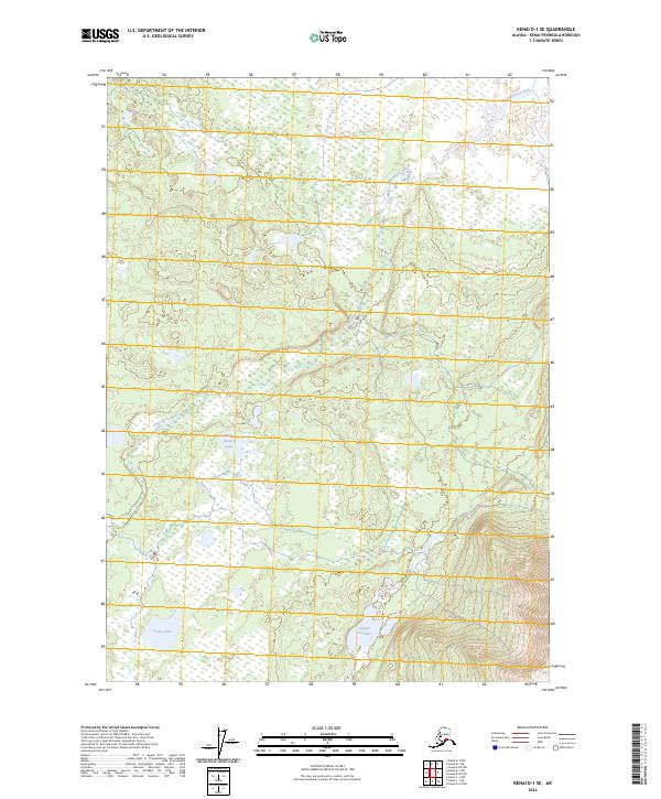
2024 Map of Kenai D-1 SE
USGS Topo · Published 2024About this map
Kenai Wilderness (Dave Spencer Unit) and the Kenai National Wildlife Refuge dominate this landscape on the Kenai Peninsula. The geography is defined by a complex network of wetlands and small basins, through which the Chickaloon River meanders toward the northeast. In the southern portion of the quadrangle, several prominent named water bodies appear, including Scenic Lake and Trapper Joe Lake, while Moose Pasture Lake sits further north. The map reveals an area largely devoid of modern road infrastructure, reflecting its status as a protected wilderness area. Surveyed sections from the Public Land Survey System, including t9n r5w and t8n r4w, provide a foundational grid for locating these natural features within the northern Kenai Peninsula Borough.
Find a feature on this map
11 named features on this map. Tap any name to fly to it.
Don’t see what you’re looking for? This feature index may not catch every label — zoom into the map to look around manually.
Map Details
Editions of this 2024 Kenai D-1 SE Map
This is the sole edition of this map. No revisions or reprints were ever made.
Other maps of this area

1944 · Kenai
USGS Topo · 1:250,000

1950 · Kenai
USGS Topo · 1:250,000

1951 · Seward
USGS Topo · 1:250,000

1951 · Kenai C-1
USGS Topo · 1:63,360

1951 · Kenai D-1
USGS Topo · 1:63,360

1951 · Seward C-8
USGS Topo · 1:63,360

1951 · Seward D-8
USGS Topo · 1:63,360

1952 · Kenai C-1
USGS Topo · 1:63,360

1952 · Seward D-8
USGS Topo · 1:63,360

1952 · Seward C-8
USGS Topo · 1:63,360