1953 Map of Kenansville
USGS Topo · Published 1965About this map
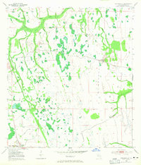
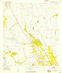
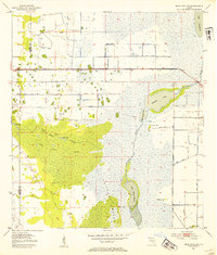
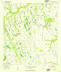
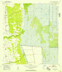
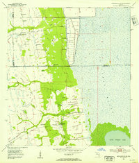
Kenansville sits at the southwestern edge of this Florida prairie landscape, marked by its position along the Canoe Creek Rd and a distinct Old RR Grade. The terrain is defined by an intricate network of wetlands and seasonal drainages, including the prominent Bull Creek and its many tributaries like Tracey Branch and Hammock Branch. Family names appear on the landscape through features such as Raulerson Branch, suggesting early settlement and land use in this part of Osceola County. The drainage patterns of Tenmile Creek and Wolf Creek flow through a patchwork of marshy depressions and intermittent ponds, such as Billy Lake and Clayhole Pond. Small agricultural or ranching markers like a Windmill punctuate the open spaces between the creek branches, reflecting the rural character of the region during the early 1950s.
Find a feature on this map
15 named features on this map. Tap any name to fly to it.
Don’t see what you’re looking for? This feature index may not catch every label — zoom into the map to look around manually.
Map Details
Editions of this 1953 Kenansville Map
3 editions found
Other maps of this area
1953 · Lake Marian SE
USGS Topo · 1:24,000
1953 · Holopaw SE
USGS Topo · 1:24,000
1953 · Kenansville SW
USGS Topo · 1:24,000
1953 · Deer Park SE
USGS Topo · 1:24,000
1953 · Kenansville
USGS Topo · 1:24,000
1953 · Kenansville NE
USGS Topo · 1:24,000
1953 · Kenansville SE
USGS Topo · 1:24,000
1953 · Deer Park
USGS Topo · 1:24,000
1953 · Lake Marian NE
USGS Topo · 1:24,000

1955 · Orlando
USGS Topo · 1:250,000