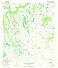
1953 Map of Kenansville
USGS Topo · Published 1973About this map
Kenansville anchors the southwest corner of this mid-century survey, a period when the Florida interior remained dominated by cattle ranching and timber tracks. The landscape is a network of slow-moving water, defined by the winding paths of Bull Creek and Wolf Creek amidst numerous cypress ponds and marshy depressions. Significant evidence of earlier infrastructure is visible in the Old RR Grade, tracing a path through the eastern section that once served the region's logging or agricultural needs. Family-named landmarks like Raulerson Branch and Tyson Creek hint at the area's homesteading history, while Canoe Creek Rd provides the primary terrestrial connection through this drainage-rich terrain. A solitary Windmill and various small ponds like Clayhole Pond mark the scattered human presence in a territory largely shaped by the natural flow of the Kissimmee River watershed.
Find a feature on this map
18 named features on this map. Tap any name to fly to it.
Don’t see what you’re looking for? This feature index may not catch every label — zoom into the map to look around manually.
Map Details
Editions of this 1953 Kenansville Map
3 editions found
Other maps of this area

1953 · Lake Marian SE
USGS Topo · 1:24,000

1953 · Holopaw SE
USGS Topo · 1:24,000

1953 · Kenansville SW
USGS Topo · 1:24,000

1953 · Deer Park SE
USGS Topo · 1:24,000

1953 · Kenansville
USGS Topo · 1:24,000

1953 · Kenansville NE
USGS Topo · 1:24,000

1953 · Kenansville SE
USGS Topo · 1:24,000

1953 · Deer Park
USGS Topo · 1:24,000

1953 · Lake Marian NE
USGS Topo · 1:24,000

1955 · Orlando
USGS Topo · 1:250,000